Fort Grey
I was advised on 16 January 2002 by:
| Bill Harvey Public Affairs Department of Transport & Regional Services (02) 6274 7860 Bill.Harvey@dotrs.gov.au | Gary Oldman - Information Technology Manager Royal Flying Doctor Service (SE Section) Ph 08 8080 1718 Fax 08 8088 4536 email gary.oldman@rfds.gov.au |
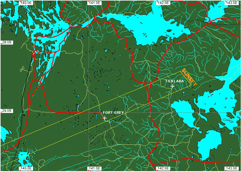
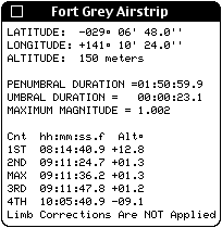
that there is an operational Airstripat Fort Grey with two 900 x 30 runways (heading 8/26 and 3/21). The somewhat off-centerline airstrip is in the path of totality and locatedat: Longitude = 141° 10' 24"E, Latitude = 29° 06' 48"S, with theadvisory "sand hills in vicinity of strip". For this location I computethe following local circumstances:
Here, the elevation of the Sun is 1.3 degrees above thehorizon at mid-eclipse and might offer a bit more comfortable "breathingroom" against any horizontal obstructions than sites further East - thoughI have not yet seen a topo to see what may lie in the line-of-site in thedirection of the Sun. This probably "acceptably" low for a nearsunset eclipse observation.
This site is accessible by a secondary road (of unknownquality, but likely OK for a 4WD) as it appears on an arearoad map. Note: From centerline, 5' to the north along the road, theduration increases by 3 seconds (to 26.2 seconds prior to limb corrections).
If the local topography is such that the view toward theSun is unobstructed, and this airstrip is viable, we may wish to use thisas our primary site rather than Bottom NarranappaTank.
Glenn Schneider
16 January 2002